| Purpose |
| In the photec! aerial photograph
scenery, the default coastline is optimized to realistic terrain. However, why is it necessary to correct the original coastline? Here, we explain about it. |
| photec!フォトシーナリーでは、FS2002への最適化としてデフォルトの海岸線を修正しています。 しかし、なぜオリジナルの海岸線を修正する必要があるのでしょうか? ここではそれについてご説明します。 |
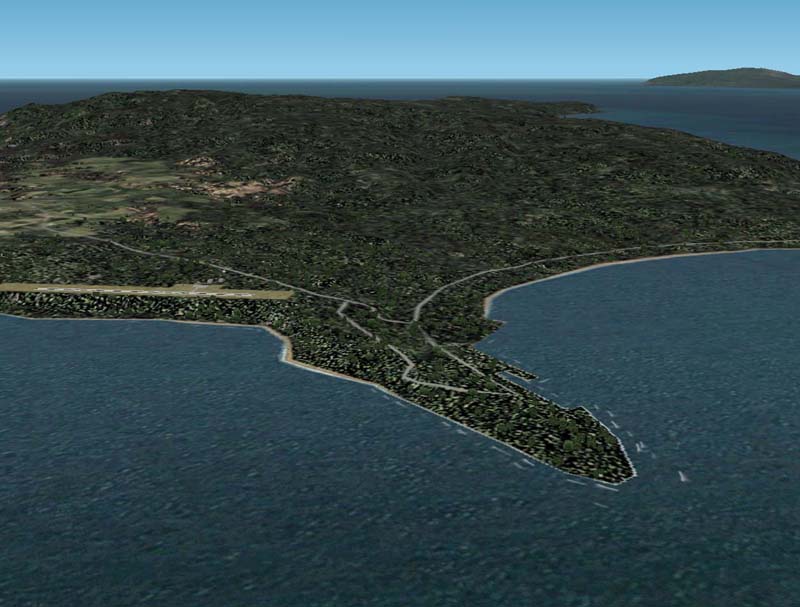
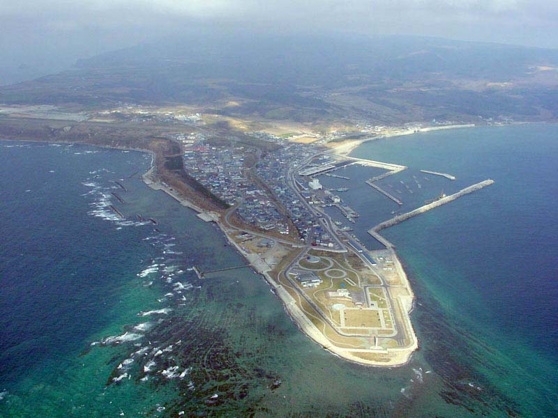
| This is the Aonae area of the Okushiri
island. (From the Okushiri photoscenery's snapshot) |
| これは奥尻島の青苗地区です。 (奥尻シーナリースナップショットより) |
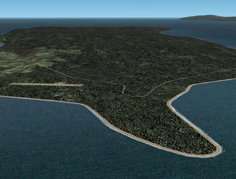
It is the same Aonae area in the
FS2002, and none of the other scenery is installed. |
| こちらは上の写真と同じ青苗地区を、FS2002で他のシーナリーを何もインストールしていない状態で表示したものです。 この様にデフォルトのままでは海岸線がかなりデフォルメされた状態で表示されます。 |
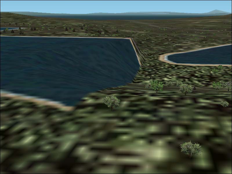
| And, this is Onuma in Hakodate area. A strange view... |
| そしてこれは函館の大沼ですが、かなりおかしなことになってます(汗) |
| The cause is,
at least in the area of Japan, the default coastline is shifted from the
actual topography in many cases. This will become quite obstructive for the photoscenery. |
| 原因は、デフォルトの海岸線などは大変粗く、しかも実際とかなりずれていることが多いのです。 フォトシーナリーを貼り付けるとなるとこれはかなり邪魔なものとなります。 |
image 1 (Mt.Hakodate with default coastline / デフォルト海岸線のままの函館山)
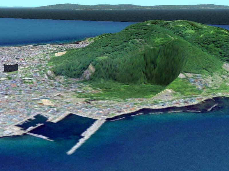
image 2 (Raiden cape with default coastline / デフォルト海岸線のままの雷電岬) 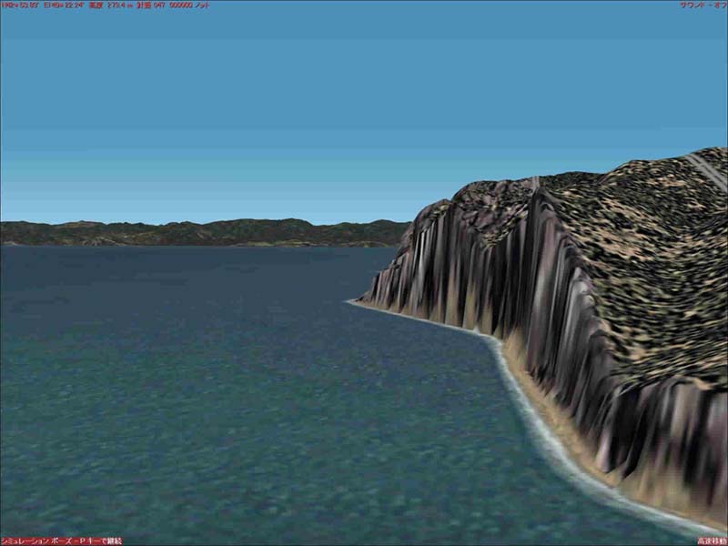
| Thus, the flattenSW is always activated
in the default water area. For this reason, we have decided to analyze more the FS2002's coastline. |
| この様に、デフォルトでは水域などにはflatten(平らにならす処理)が強制的にかかっています。 このような状態を解消したいと思い、FS2002を深く解析してみることにしました。 |
| In our Tools Dowonload Page, the TGP
Editing tools are available to download which edits this default coastline
and the surface of the earth in detail. It was developed for company use, so it is an incomplete program. |
| downloadページのTGP Editing toolsは、このデフォルトの海岸線や地表のポリゴンを詳細に編集するプログラムです。 社内向けに開発したので使い勝手は悪いです。 |
The Okushiri island edited by TGP editor / 奥尻島青苗地区をTGP Editorで編集してみました。